| |
| Stage 3 - The Trans-Caledonian Way |
|
What do you mean, you've never heard of the Trans-Caledonian Way?
Maybe it's something to do with the fact that we invented the name to describe our route East and North across Scotland from Inverness to
Ullapool.
It all began in September 2005 when we walked the West Highland Way, we were bitten by the bug. Actually, we were bitten by several bugs, and
stung once or twice too but specifically the bug we're talking about here is the long-distance walking bug.
After the WHW we tackled the Great Glen Way and, once completed, we
decided that we wanted to continue our walk all the way up to Cape Wrath. However, rather than
follow any routes in the books, which tend to start from around Fort
William, we decided to "join the dots" and continue walking from Inverness, tackling the journey in two stages.
The plan for this leg was to drive to Ullapool, dump the car, take the
bus back to Inverness and start walking back to the car the next day.
We were also planning on bagging
some geocaches on the way and, since this account was written originally for the Geocaching community, there will be mention of these as we go along. I'll mark them like this so that non-geocachers will know what I'm on about.
The long drive up to Ullapool was punctuated by a couple of stops for
coffee and on the first of these I realised that I had somehow screwed
up all the clues for en-route drive-by caches in my PDA. However, it
was no catastrophe as I still had everything we needed for the caches
we intended to bag on our walk.
On the way Celine had the tremendous idea of dropping off our camping
equipment at the lodgings we had booked for our third night, since we
wouldn't require any of it until our 4th night onwards, thereby losing
about a third of the diabolical burden that we were so not looking
forward to bearing.
All went according to plan, thanks to fortune and amenable hosts. The
sun shone all day and the forecast was good for the remainder of the
week. While we were waiting to catch the bus from Ullapool to Inverness we wandered
through the village to look for a geocache called "Inter-resting" in Ullapool?? After searching for a while we phoned our sons at home and, following a bit
more of a search, we found it. Unfortunately neither of us had a pen on us to sign the log so we decided to return and sign it the following week.
At Inverness we had a meal at our hotel and went for a stroll along the
river, picking up the Bellfield Park cache while we were out.
|
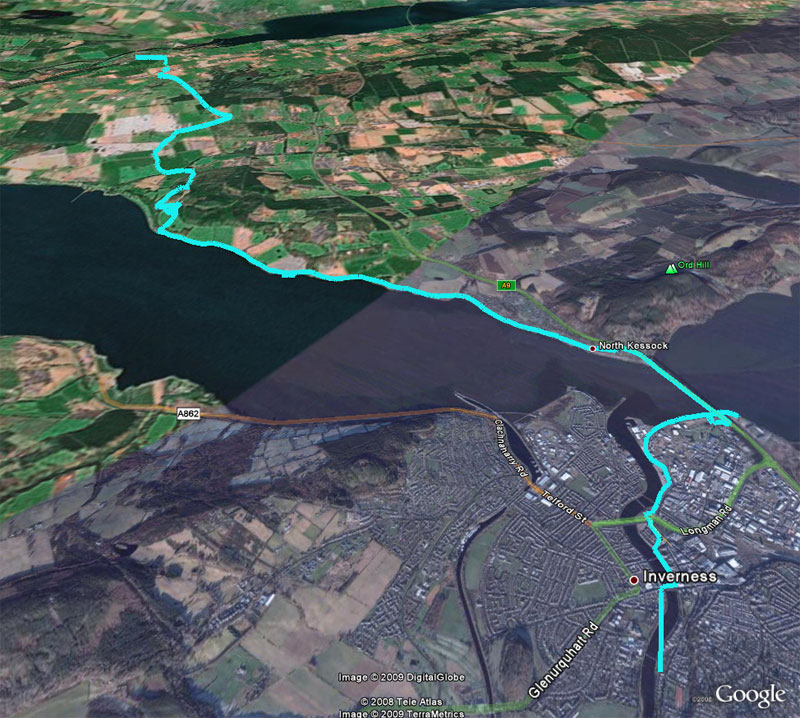
Sunday April 29th 2007: The next day dawned bright & sunny and we were out early with only a
full Scottish breakfast to sustain us. We quickly noticed that our backpacks were uncomfortably heavy and we were glad we didn't have to
carry our camping gear for the next few days.
Our first halt was at The Citadel, a cache'n'dash (easily accessible geocache) which gave us an excuse
to stop for a while & take the packs off (we had a great deal of those
excuses, believe me).

Beneath Kessock Bridge, Inverness
Next, it was over Kessock Bridge with its views over the Firths and
onto the Black Isle, following the coast until we stopped for a refreshing pint at a caravan site - most welcome since the sun was blazing. Suitably sated, we cut up over Gallow Hill, losing our path for a while until we joined the beautiful forest tracks up to Gallows Hill Cache.
Onward then, to Kilcoy and Lest We Forget, one of a series of caches
set around memorials. This was next to a charming art gallery and we
took out the stove and brewed a cuppa while we waited for the
fence-painting muggle (non-geocacher) to take the hint and bugger off for a tea break.
Which, eventually, he did, giving us the opporchancity to grab the cache.
Unfortunately, we had no knowledge of local paths and the best route we could make out on the map had us walking a considerable distance along the main road.
Some miles later we located our final cache for the day, Lest We Forget - Conon Bridge. Some yards later we located our lodgings - the Conon
Bridge Hotel and treated our poor old tired bods to a couple of pints
of Mr. Guiness's curative potion. I'm delighted to tell you that our
room was large and comfortable, as was the bath in our en-suite.
Ah, bliss.

H2O identification - correct

H2O identification - incorrect
Distance walked - 16 miles |
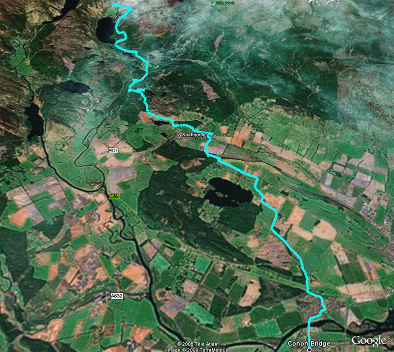
Monday April 30th 2007: Next morning dawned misty and was welcomingly chilly as we walked out
of Conon Bridge heading for lunch at Strathpeffer. The countryside
here was gorgeous and we were treated to the sight of a large buzzard
perched on a telegraph pole. As we reached the top of the last hill
before Strathpeffer we met a local character who reminded us both of
Jimmy Saville for some reason and who was interested in the route we
intended to take. He recommended a book called "Memories of
Strathvaigh" by Kenneth Mclennan, which tells of the "Herring Trail",
part of which we would be following. We haven't yet been able to find
a copy.
Down the hill, then, to A-Maze-ing View. This is a wonderful cache
site with a fascinating labyrinth composed of large rocks taken from
all over Scotland. Its quite amazing to ponder that Lewisian Gneiss
was actually formed before planet Earth possessed an oxygen atmosphere!
We can highly recommend a visit, and on the other side of lovely
Strathpeffer you can find another very interesting site when you look
for The Eagle Stone Cache. This Pictish stone pre-dates Christianity
in Scotland.

The rock labyrinth at Strathpeffer
Pressing onwards, and really feeling the weight of our packs in the
now-searing sunshine, we headed up to gain a staggering view of Loch
Kinellan (well, we were definitely staggering anyway).
Which reminds me of two important Principles of Walking which cock a
snook at the accepted Laws of Physics.
1. There is more uphill than downhill.
2. The final mile is never less than twice the length of the first mile.
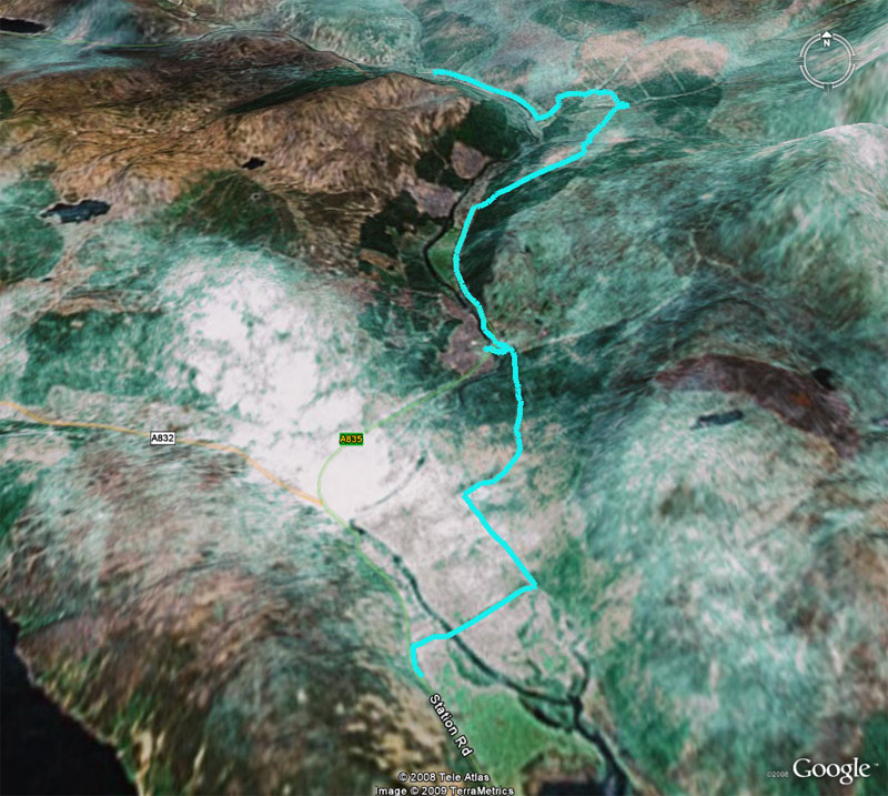
More wonderful forest paths led us to the cache named Rogie Falls,
which is actually a bit of a walk from the Falls themselves, but
nevertheless a great spot to rest beside little Loch na Crann and brew
another cuppa.

yob kulcha on the metal bridge over the Rogie Falls
From there we followed the trail down to the Falls, which could have
done with a bit of topping up after all the sunshine. Somewhere around
here we stopped for a breather and we both noticed what looked like a
large, neat pile of freshly swept pine needles. Then we saw that
it was writhing, and realised that it was, in fact, a large neat pile
of wood ants in their nest. Our fear of biting, stinging nature
prevented us from inspecting any closer, and so we pressed on for the
final push towards Garve, and our lodgings at Birch Cottage.
Now, Birch Cottage's secret weapon is mein host, Ray, who, as well as
being a jolly nice bloke, is also a gourmet chef.
I have rarely tasted food so good as our meal that night. The
vegetables accompanying the exquisite pan-fried duck were uniquely
tasty and the words "chocolate cheesecake" do not do justice to Ray's
culinary concoction. And I didn't even mention the smoked salmon
starter. Mmmmmmmmm.
Distance walked - 15.2 miles
|
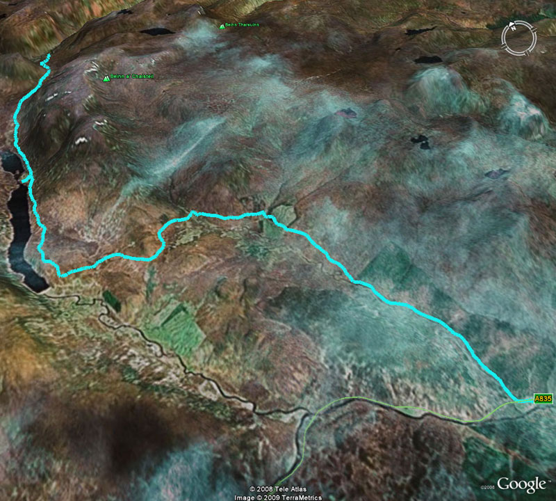
Tuesday May 1st 2007: There were no more caches on our route for the next few days. Another
sunny, but thankfully short day saw us heading North to Inchbae Lodge.
Unfortunately, a couple of miles down the road, our path was blocked in
one direction by large, heavily padlocked metal gates whose equally
large sign warned of extreme danger of an unspecified kind on the path
ahead. Our alternative route did not possess the same impregnable
barriers, but its small sign boasting of a large Rottweiller which
could reach us in 3 seconds flat gave us cause to pause...just long
enough to see something large, hairy and dead lying a short distance up
the path at which point we stopped pausing and began walking in the opposite direction. Although we saw no sign of any (live) animal bigger than the annoyingly yappy Jack Russell barking at our heels we concluded
that it was possible that he may, indeed, have a larger and more
droolingly-fanged friend.
Sadly, this meant that our only viable option was a couple of miles
walk along a main road. However this was relatively fine since the
verge was large and the cars were few.
We were soon back up on lovely forest tracks again (going uphill,
natch) and once again we were finding it a bit of a struggle under the
cloudless sky. A close inspection of the map, though, showed no clear
path down if we kept going to the edge of the forest and so we returned
to the main road for the last couple of miles, noticing, as we passed,
the very clear, easy and lovely downward path which would have been
ours had we kept going. A "D'Oh!" moment if ever there was one.
And so we reached Inchbae Lodge and a large room with an unexpected
4-poster bed! Oh, well. The next 3 nights we were going to camp in the wilderness so we enjoyed the luxury while we had it.
The food at Inchbae lodge? We can't say really. We had been so
enthusiastic about Ray's cooking at Garve that Linda, meine hostess,
had offered to come and pick us up and, after dining at Birch Cottage,
return us to the Lodge.
Mmmmmmmmmm again. What lovely people. We were introduced to their other guest, Tony. He's an ecologist studying habitats in advance of
the Pylon/Underground cables scheme that you may have heard about.
He travels with his dog, Jack, and in the course of the conversation he
mentioned one time when Jack stopped dead in his tracks, sniffing the
air and growling, with the fur on his neck standing up. This was
unusual behaviour for Jack and so Tony had a scout around and found
some unusual animal droppings, which he bagged and sent to a friend of
his who is a scatologist (yes, they have a name for those kind of
people).
The droppings were identified as those left by a big cat - specifically,
a leopard. So that was nice to hear on the eve of our venture into the
wilderness, wasn't it?
On our return to the Lodge we had a couple of pints and a wee whisky.
Not dutch courage you understand. Nope, not at all.
(Actually, although it's well-known that there are big cats in the
Highlands, like most animals they'll keep well clear of humans.
Nothing to be afraid of. Ok? I'll just have one more wee dram then).
Distance walked - 8.76 miles
|
Wednesday May 2nd 2007: Next day we packed our camping gear into our backpacks and very near
got the bus to Ullapool - they weighed a ton! Even though we thought
we had been merciless with our packing we realised that we should have
been utterly ruthless and discarded some of the non-essentials. The
large golfing umbrellas seemed to mock us in the midst of the highland
drought.

yob kulcha heads for the hills - some miles out from Inchbae
The day was long, hard, hot, exhausting and really quite rewarding in
several ways. We saw an eagle soaring over hills in the distance. I
cooled down in a deep blue loch with not even a hint of jet-skiers to
set me to cursing. And the image of Deanich lodge in the sunset seems
to have been tattooed onto my memory.

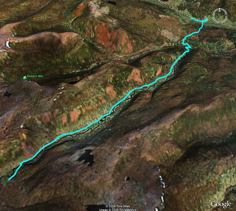
Abandoned buildings at Lubachlaggan
Deanich Lodge is a large, white building with a couple of outhouses, and sits near a river at the meeting place of three glens. It was empty as we
passed by. We pitched our tent some distance away but returned to the
burn near the house to get some fresh water. On our way there a
40-strong herd of red deer wandered in from another glen and grazed
close to the house, keeping several watchful eyes on the humans
hobbling slowly towards them.

Celine approaches Deanich Lodge
In the evening we lay in our tent and listened to the noisy squabbling
of the Oystercatchers by the river and, later still, we crept out of
the tent and watched a silvery moon keek out from behind a hill,
throwing silver-blue beams into the thin mist which parted in patches
to allow us glimpses of familiar constellations.
Which was all very well and good but it was bloody freezing and so we
hastily retreated back to the tent and our snug (but very heavy)
sleeping bags.

Oor wee tent near Deanich Lodge
Distance walked - 13.5 miles
|
Thursday May 3rd 2007: As we rose the next morning the sunlight was hitting the high tops and
the mist was retreating, thin strands being blown up the course of the
river by a gentle breeze. After a breakfast that in no way could be
described as "full Scottish" and which, come to think of it, would
surely fall foul of European trade descriptions legislation should the
Belgians happen to overhear you describing it as "breakfast", we packed
the tent and moved on. Somehow, despite our small ecological
footprint, our meager supplies and the fact that we could carry
everything with us on our backs (only just), this process took us 3 and
a half hours. Just as well it was only another short day's walk for us.

Red deer silhouetted against the horizon near Deanich Lodge
Surprise, surprise, it turned out to be another blazing day. As we
trudged onward through the slowly-changing scenery we were passed by a
Land-Rover on its way to Deanich Lodge (we could tell because later we
saw smoke coming from that direction). We realised that the car's
inhabitants were the first human beings we had seen in more than 24
hours.
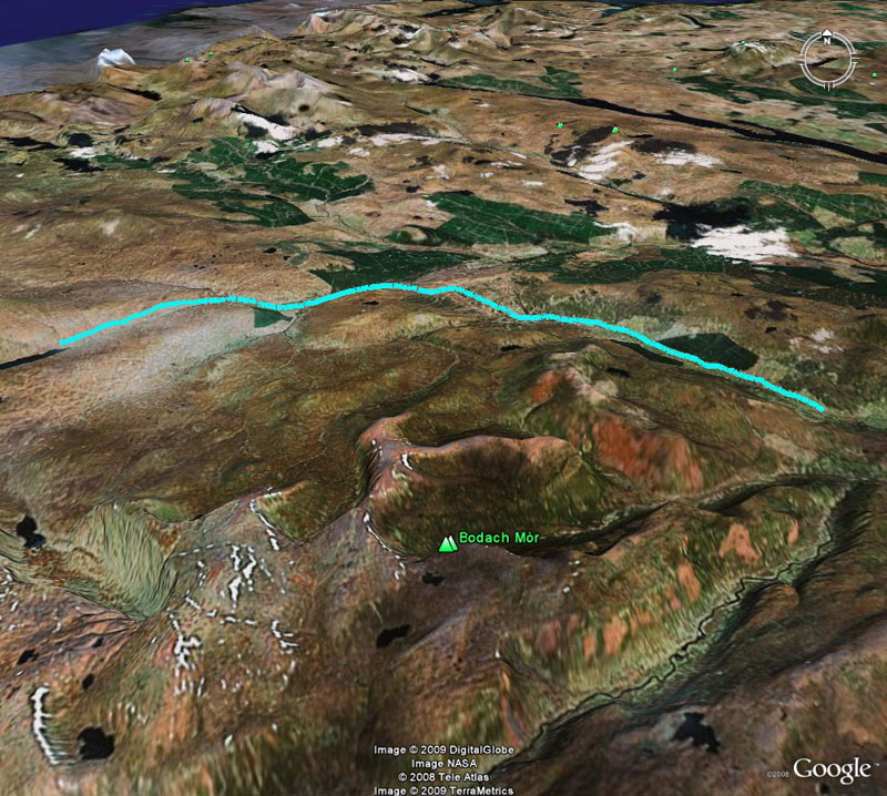
As we reached the end of the glen we began to climb steeply (now
there's a shock) and arrived at magnificent Alladale Lodge which must
surely boast one of the finest views from a comfy chair that bags of
money can buy. Alladale's owners are seeking permission to reintroduce indiginous wildlife to the estate, so at some point in the future you may find yoursef walking among beavers, wolves and bears. There was a man in a workshop near the big house and we hailed him to ask if we were on the right path to take us around the
house to our outward path.
"Hello there", I ventured, turning to take in the vast scenery, "Nice view you have...HOLY CRAP WHAT'S THAT??"
The outburst was due to my having seen a huge gray blur whizz up from
the glen and behind the house. A second later an RAF jet fighter burst
out from the sky above the house and roared over our heads, so close
that you could count the pilot's freckles. It was gone in an instant."As I was saying", I continued, "Nice view you have here, but bloody
noisy neighbours!"

Above Alladale Lodge
If any of you are thinking of following this route then take note;
although the OS Explorer map clearly shows a path over the hill from
Alladale and down to Croik, it's little more than an animal track and
is easily lost - it must be even harder to find in the Summer. However, we reached Croik with little fuss and grabbed
the Croick Church cache. (I know the spelling's inconsistent. Blame
the maps). This is another one of those caches that is an absolute
pleasure to find and we found the church to be a great refuge, taking
the liberty of resting inside out of the sun and brewing up a
refreshing cup of coffee. I even got a chance to do my Ivor Cutler
impersonation on the church harmonium.

Croick Church
Another night in the tent, another rabble of Oystercatchers and. in the fields, lots and lots of ickle baa lambs. Aww.

Aww, ickle baa lamb!
Distance walked - 10.1 miles
|
Friday May 4th 2007: Up and out to a refreshingly cloudy morning. After breakfast (apologies to Belgium) we trudged up hill and down dale, but mostly up hill. The
high point here (literally) was on moorland which provided us with a
fantastic view of 3 very distinctive mountains, An Teallach to the
left, Suilven directly ahead and (I think) Ben More Assynt to the right.
We noticed lots of very large paw prints around about here but whether
they were made by a large dog or a leopard neither of us could say. However, a little later we saw the remains of a sheep with a very large hole instead of guts and, sometime later still, we found the scattered and smelly remains of a fairly freshly killed baby deer. I'm no expert but my money's on the leopard 
Our destination that night was to be the bothy at Knockdamph.
Neither of us had ever stayed in a bothy, although we had passed many
by, and after a long day's walk we were gladdened to see its chimney
against the sky in the distance. Somehow, even though the GPSr told us
it was only a mile distant, it seemed more like 2 or 3 miles walk to
get there. See rule 2 above.

Knockdamph Bothy chimney
As we approached the bothy the sun came out and upon our arrival we
were able to put up the tent and dry off that morning's dew, even though we wouldn't need oor wee tent again on this trip.
I can highly recommend this bothy. It has been very well cared for and
stocked by the Mountain Bothies Association www.mountainbothies.org.uk
and it provided us with shelter from the wind which picked up and chilled
remarkably as soon as the sun disappeared behind the hill.
We were joined by a fellow walker, Richard, who had walked all the way
from Fort William via Ullapool on his long walk to the Cape. We got a
fire going and sat chatting until our little ration of wood had expired
and he retired to the upper floor of the bothy, leaving us to the lower
room and the remains of the fire.
Distance walked - 13.8 miles
|
Saturday May 5th 2007: Next day we were all up early and out into yet another sunny morning. On leaving the bothy we found a tic-remover that Richard had dropped. This was to come in useful in the final part of our Long Walk North.
Ouch. The blister I had been developing the previous day hadn't
magically disappeared overnight as I had hoped and, despite the mighty
powers of Compeed and other protective spells I knew it was going to
give me gyp for the rest of the day. And so it did.

Boat House at Ridorrach
But never mind. This was our final day and our hearts were light.
Unfortunately the same can't be said about the backpacks. We knew we
were close to our destination when we found Broom With A View which I
imagine is quite a nice walk from Ullapool. Trust yob kulcha to do it the hard way - from Inverness!
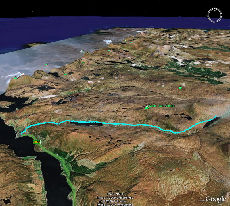
At last we arrived footsore but happy in Ullapool. After
unceremoniously dumping the backpacks in our hotel room we practically
ran down to the pub for a celebratory pint or two (our first since
Inchbae). We nipped out, pen in hand this time, to finish our business
at "Inter-resting" in Ullapool?? and on our way back to the hotel we
felt the familiar but long-forgotten sensation of raindrops on our
heads. Unbelievably we had spent a week walking in the Scottish
Highlands and we had cracking weather every single day!
And no midgies.
And that's pretty much it. On the drive back the next day we bagged a
FTF (First To Find a new geocache) at Corrieshalloch Gorge Earthcache and we couldn't drive by
our friend Highland Nick's "Slochd Stagecoach" without saying hello.
PS shortly after we returned home Celine exchanged emails with Ray and is
now in possession of his recipe for Chocolate Cheesecake. Bon appetit
Distance walked - 12.2 miles
|
|
Return to Long Walk North |
|
| |
|
|
