Gerry and Celine's long walk
Around Arran
| Around Arran |
|
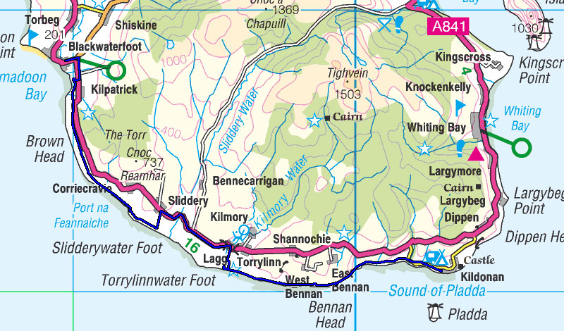
Day 2: Kildonan to Blackwaterfoot Day 3: Blackwaterfoot to Pirnmill Day 4: Pirnmill to Lochranza, Brodick to Corrie
After completing our Long Walk North last year we very definitely decided "Never again". These long walks are just too knackering and we ain't getting any younger. However, time passes and the selective memory discards (or buries) the trauma and highlights the good times. And so the madness returns. This year we thought that we could have more of a holiday and so we decided that a nice wee walk around the beautiful island of Arran would be almost relaxing compared with last years trek. Will we never learn? We set out on Saturday May 2nd and got tickets straight through from Glasgow to Brodick at just over a tenner each, which included the ferry. Great value! The day was bright and sunny and Arran's mountainous silhouette drew closer and more inviting. On reaching Brodick, the first person we met was Natalie from Project Ability, the charity organisation that we were raising money for on our walk. She was in Arran to DJ at a wedding in Lochranza. Small world, eh? Since this was our first trip to the island we spent some time walking around and familiarising ourselves with Brodick before heading off to our B&B to dump our bags. Next up was our first Geocache of the trip. Geocaching is a hobby that we picked up in 2005 when we were preparing to walk the West Highland Way and we still find that it can be an excellent way to get to know places of interest if you're a stranger in town (or country). The cache itself, Arran Industry - Sand, is only a few minutes easy walk from Brodick and can be found quite easily - if you know where to look. Afterwards, we had a meal in the very Excellent Brodick Brasserie before retiring early in anticipation of a long day's walk tomorrow. |
Sunday May 3rd 2009: Day 1
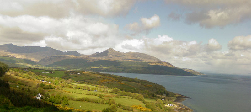
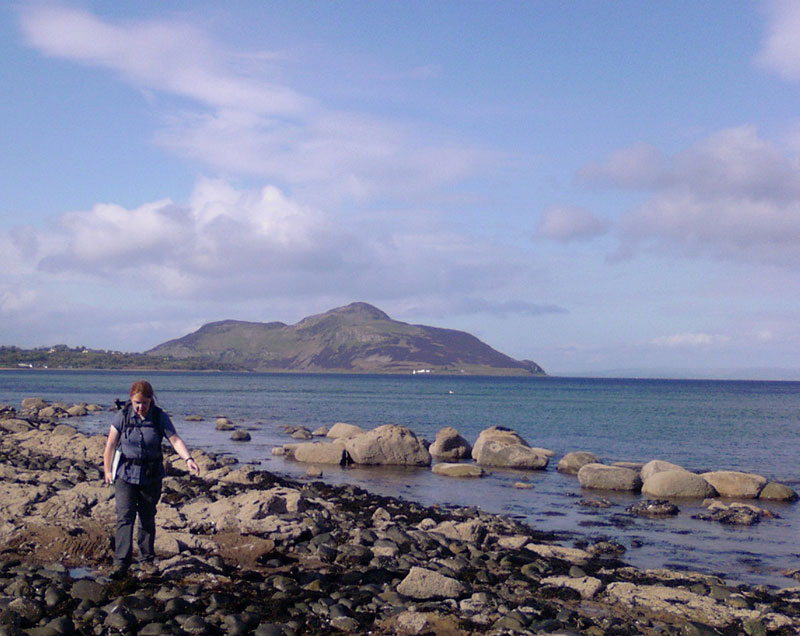
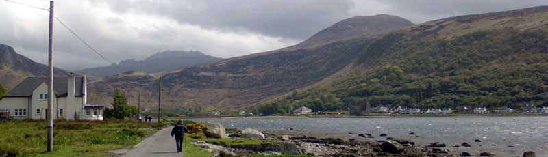
Patriot with a view
From the hilltops there are magnificent views back to Brodick and Goat Fell and ahead to the Holy Isle. From Claughlands Point we made a sharp turn right, since walking straight ahead would just have got us a dunking in the Firth of Clyde. Occasional light showers were keeping us company on the path along to Lamlash, where we stopped to savour a pint of Arran Ale. We saw seals basking on the rocks - the most exotic wildlife we were to see on our whole journey.
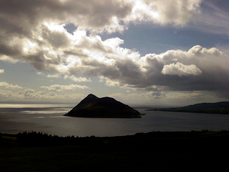
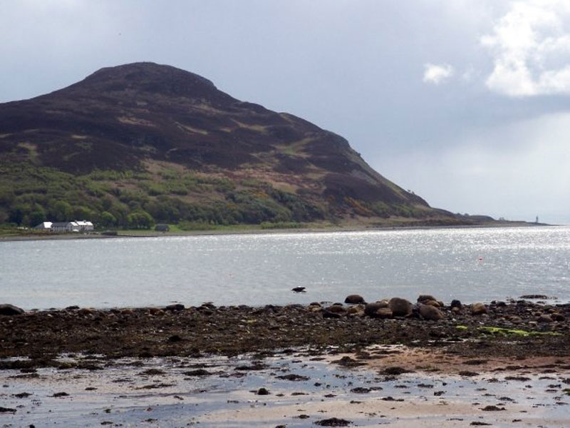
Holy Isle
Holy Cows?
That's a seal there, really. It's basking. Suitably refreshed, we carried on along the main road for a short while until we turned off onto the cycle path which follows a forestry path to Whiting Bay. Here we found our first Geocache of the day, Arran Industry - Cloth, a pleasant wee diversion at the edge of the forest. Moving on, it was a grand walk up through the forest. The weather was so unpredictable that we were never sure whether to keep the waterproofs on against the rain, or take them off in the hot sunshine. As we descended into Whiting Bay there was a gorgeous smell emanating from the bright yellow gorse along the path - a kind of aromatic odour not unlike coconut or almond or vanilla. I've never noticed the smell before and I tell you, you could make sweeties out of it and I'd eat the lot. As we walked into Whiting Bay the sun was behind us and there was a very fine misty rain ahead, creating a sheet of spectral colour that looked like a wide, flat and scarcely discernable rainbow ahead of us. So we stopped and had a quick pint in the pub, and when the rain had stopped we went outside and tended to our weary feet before setting out on the last leg around Dippen Head to Kildonan.
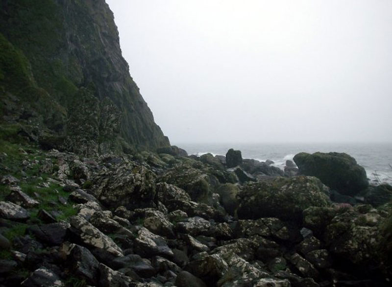
Celine picks her way through the rocks which were soon to become larger and slippier Soon after leaving Whiting Bay the "Coastal Way" takes you off the road and onto the rocky seashore where you can see Ailsa Craig, as long as the weather holds out. There isn't a path, as such, and you just have to make your way as best you can. This is slow going, and it becomes much slower when you get to the big rockfall later on. At first, the inner child laughs with joy as he clambers over the jumble of huge boulders which litter the southeast corner of the island, but it's not long before the inner child starts greetin' for his mammy as the rockfall stretches on, and on, and on...
Ailsa Craig - "Paddy's Milestone" - and the ferry to Ireland
Ailsa Craig through rocks
Cormorants and Royal Navy ship. Insert "shag" joke here... Celine was finding the clambering particularly hard going so I had plenty of time to stop and take pictures :) However, we eventually reached the end of the large rocks. Unfortunately, we weren't home and dry yet. In fact, the rain started falling in earnest and a cold wind picked up. The rocks, although smaller, became very slippy and the flat basalt slabs lying in our way were like skating rinks. This skiddy surface was interspersed with muddy, boggy ground and, tired as we were, we began to get a bit fed up of the whole trek. Eventually, this terrain gave way to sand and shingle so we did our best to keep to firm sand where possible. We could see the lighthouse on the little island of Pladda and knew that Kildonan wasn't too far away. At last we passed the ruin of Kildonan Castle and shortly thereafter nearly walked right past our hotel. Luckily we didn't and we enjoyed a fabulous meal in the Kildonan Hotel, followed by a lovely hot bath and a good night's sleep. Distance walked - 18.1 miles |
| Day 2 - Kildonan to Blackwaterfoot |
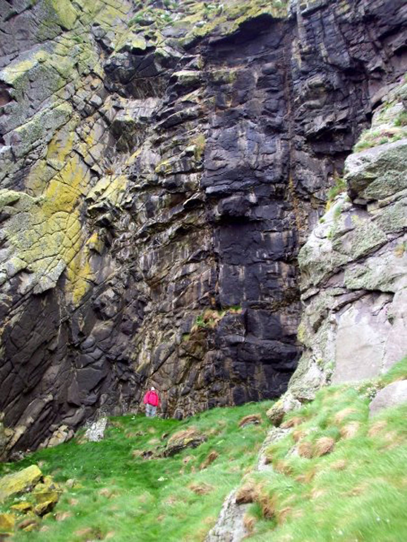
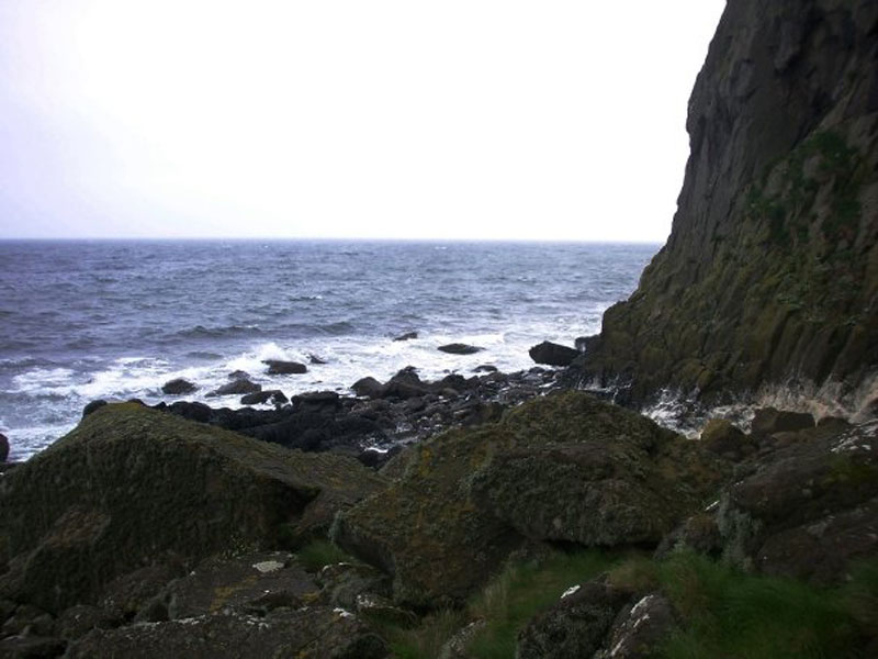
Monday May 4th 2009: Day 2 We awoke to a wet and stormy morning. As we sat eating our breakfast we weren't looking forward to facing the elements. The sea was very choppy, the clouds were hiding the lighthouse on Pladda and the wind was throwing the hanging baskets around so much that a hotel employee had to go out and take them down. Still, we had to get on with it. The walk along the shore started off sandy, then became rocky before eventually deciding on being muddy for a long while. After the mud came more large boulders and slow clambering. Eventually, you end up very close to the sea as you approach the Black Cave. In fact, if you want to explore the area around here then you must check the local tides as the caves are inaccessible at high tide.
Not the Black Cave
How do we get around there?
How did we get around there? We spent quite a while exploring the first large cave that we came to, searching for a geocache. We had no luck until we gave up, scrambled around the slippy, frothy. spume-covered rocks and discovered the REAL Black Cave just around the corner. The geocache was an easy find after that.
The Black Cave
Celine picks her way through the boulders after leaving the Black Cave There followed more rocks & boulders and we were always close to the sea. The terrain then turned boggy again and between the mud and the rain we were getting soaked through. Leaving the boggy terrain behind us, we had a trudge along a sandy beach before reaching a wide river. There are stepping stones marked on the OS map but all the rain had swollen the river so that trying to cross it would have been unwise. So we headed up through the fields to Lagg, where we enjoyed some pub grub at the hotel as we sat in front of an open fire, trying to dry off a bit. The rain eased off a little after lunch and we had a few miles of road to walk on before heading back down to the coast. The walk from here was quite unpleasant, once again we had lots of boggy, muddy ground which had been churned up by cows. More mud and boulders followed, then grassy tufts and boulders, then boulders and rumours of a path. All the way along this stretch we noticed that there was a large amount of plastic littering the coast. Looking at all the waste it's sadly all to easy to imagine how this happened. A few miles out from Blackwaterfoot a proper path appears and the walking gets considerably easier for a while until you reach the Preaching Cave. After this, the path disintegrates and once again you're walking along a soft, sandy beach. We had taken almost 10 hours to walk about 12 miles and we were concerned that we might not make it to Blackwaterfoot in time to buy a hot meal so we decided to leave the beach at the earliest opportunity and head for the road where we might manage to speed up a little. As it turns out, the main road heads away from the town at the point we joined it until it meets a junction with a smaller road leading in the right direction. We ended up walking almost twice the distance along the road than we would have if we had stuck to the beach - but at least we were moving faster and we got into town just in time to get the final meal orders in the Kinloch Hotel before heading over to our digs at the Blackwaterfoot Lodge.
Distance walked - 14.2 miles
|
| Day 3 - Blackwaterfoot to Pirnmill |
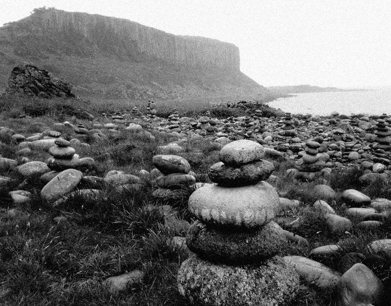
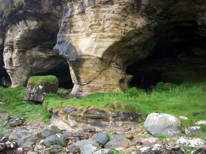
Tuesday May 5th 2009: Day 3 In the morning we sat in the breakfast lounge watching the wind whipping the rain around and hoping that the weather forecast was wrong. But it wasn't. It's a nice walk out from Blackwaterfoot, through the golf course and down by the cliffs to the King's Cave.
Rock garden near Blackwaterfoot
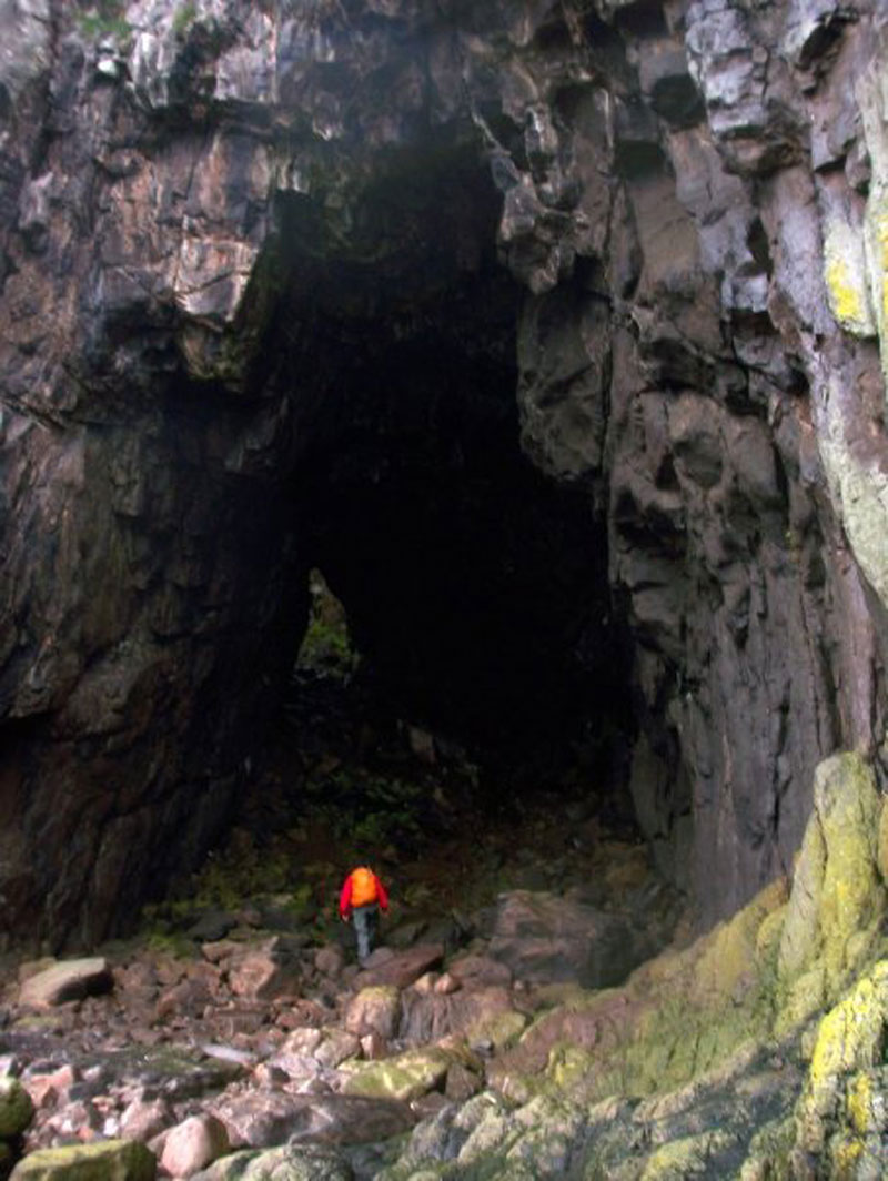
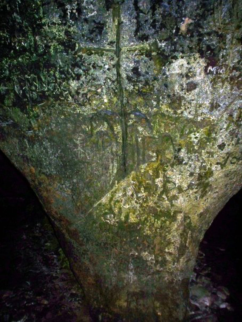
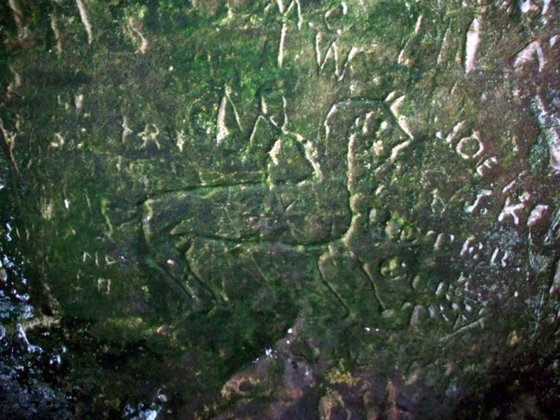
Rock garden and cliffs The gate at the entrance to The King's Cave was unlocked and we were able to get in and explore it using our head-torches. It's covered in drawings and grafitti both ancient and recent and is a fascinating place to visit. There's also a geocache nearby and we quickly found it before heading back out into the rain.
Carving in King's Cave
Carving in King's Cave
Limestone arches near King's Cave There's a pretty decent path from the caves and we followed this around the coast and up to the top of the cliffs as it headed inland beside a forest. Despite the rain, we were enjoying the walk and instead of sticking to the coast we just kept on this track until we reached the main road.
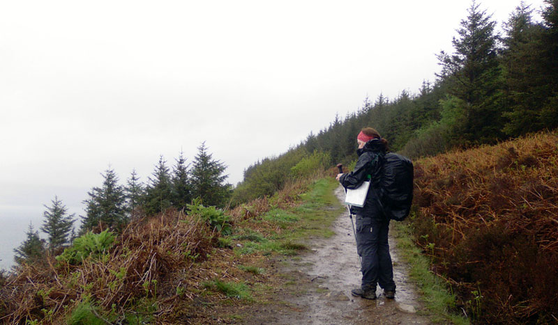
On the clifftop path above the King's Cave, Celine receives an important phone call from a work colleague To be honest, we weren't looking forward to this part of our journey since walking on roads is rarely a good experience and we had no alternative but to stick to it for the next 10 miles or so until we reached Pirnmill. There's a cafe beside the Golf Course at Machrie and we stopped there to get out of the rain but it wasn't particularly well heated and we sat down, soaked and shivering, for a cup of tea and a warm meal. There's a geocache near the cafe and after finding it we carried on with our walk. The remainder of the day consisted of a long, wet, windy, blistering and generally not very pleasant road walk. We became experts at identifying Scottish rain as it drizzled, teemed, bucketed, lashed, poured and pished on us relentlessly. Our spirits were low so to keep morale up we invented one of our stupid word games. This one went along the lines of: "Would you rather see a giraffe with a caraffe or a mole with a bowl?", or, "Would you rather see a snail with a pail or a whale's tail?". This was one of our more intelligent conversations.
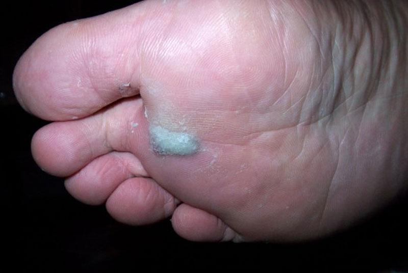
This is what several miles of road walking in soggy shoes does to your feet. At least when you're walking on a road you can move quite swiftly and we were in our B&B in Pirnmill by late afternoon. The opportunity to have a hot shower and to change into dry clothes wasn't wasted and later we had a delicious meal in the excellent Lighthouse Restaurant in Pirnmill. Distance walked - 12.7 miles |
| Day 4 - Pirmill to Lochranza, Brodick to Corrie |
Wednesday May 6th 2009: Day 4 Oh no, not again! It's still raining this morning and, if anything, it's even windier. We had managed to dry all our clothes overnight and we had packed our soaked boots with newspaper and left them near the fireplace. Within half an hour of setting out we were drenched again and we were facing another 6 or 7 miles of road walking before reaching a more coastal path near Lochranza. There was a possibility of getting off the road a little earlier by taking the "Postman's Path" near Lochranza but we had been warned against it by a couple we had met at the King's Cave and who were walking around Arran in the opposite direction from us. I was already a bit wary of it since the guidebook that we had described it as "wet - a good opportunity to wear your wellies". Given that the guidebook had mentioned little about the boggy stretches we had encountered on our journey so far I wasn't sure how bad conditions underfoot had to be before they were described as "wet". Our fellow walkers had described how they had struggled through the "Postman's Path" by balancing on grassy divots and how their walking poles occasionally sank in the mire right up to the handle. We decided to give it a miss. By the time we reached Lochranza neither of us was inclined to spend the rest of the day struggling over 11 miles of slippy rocks and muddy paths in the lashing rain and gale force winds so we went to the pub to rethink our strategy.
Deer at Lochranza Castle After a few pints of strategy enhancing ale we came to the wise decision to abandon the coastal route until tomorrow. Instead, we got the bus down to Brodick Castle and walked the 4 or 5 miles North along the road to our hotel at Corrie. Distance walked - 11.5 miles
|
| Day 5 - Corrie to Lochranza |
Thurday May 6th 2009: Day 5 The occasional showers didn't bother us as we were just grateful to have a day without an incessant downpour. The walk up the shoreline was very pleasant but we were slightly disappointed that we didn't see any of the marine life that often visits this part of the island; dolphin, porpoises, basking sharks and Minke whales have all been seen here. But not by us.
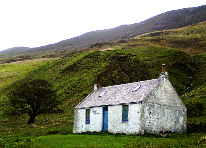
Celine approaching Laggan Cottage
Laggan Cottage
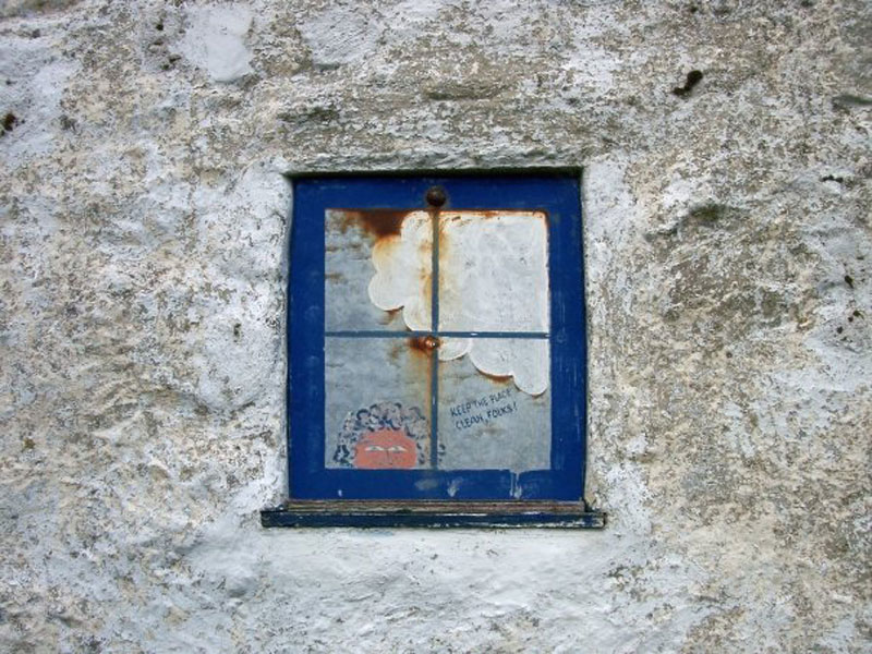
"Window" at Laggan Cottage. They're all just painted on.
Eroded sandstone formations near the Cock of Arran. Alright, go on, snigger. The day had passed quickly enough, and although the path deteriorates as you head further North, and you encounter a large rockfall - An Scriodan - it's nowhere near as mucky, rocky or treacherous as the "paths" we had been on for the first couple of days.
This area is geologically very varied and it was here, among other sites, that James Hutton recognised the Unconformity that would lead to a theory of earth's history that shook the foundations of scientific thinking in the 18th century. Nearly there. As we approached Lochranza we found it a bit of a struggle as we turned and faced the teeth of the gale force wind, but we struggled on and, anticlimactically, reached the bus stop outside the distillery to await the bus back down to Brodick.
At last, battling against gale force winds, Celine approaches Lochranza, So, here we are once again at Brodick Castle. All that remains is for us to "join the dots" and walk back into town and complete our circumnavigation of the island. It was a nice wee stroll along the beach and through the town to our B & B, and after a shower and a change of clothes we headed back into town and straight to the Brodick Brasserie for one of the best meals I have ever tasted. Seriously. The weather forecast is for more gales and rain tomorrow so we've decided to postpone our climb up Goat Fell for another, brighter day. Distance walked - 13.7 miles
|
| Epilogue |
Ok, let's just make one thing clear. There is no "Arran Coastal Way". It's a myth or a dream or a poorly conceived joke but it's certainly not a good walking route around the island. For a start, walkers don't like roads - they're boring and they almost guarantee blisters. Motorists have to pull out into the wrong side of the road to avoid you and that creates a dangerous situation for everyone. And yet for a ridiculously long and arduous part of this route it is necessary to trudge along Arran's narrow and potholed roads. Much of the rest of the route is either boggy, muddy, sandy, rocky or otherwise a pain in the arse to walk around. If you really want a struggle around inhospitable terrain then by all means have a go, but if you want an enjoyable trek then pick a few choice starting points and enjoy this beautiful island in a series of shorter walks - and they are here in abundance.
|
|